16,000+ Campsites Personally Checked By Our Team Since 1992

Do you know Australia’s extreme north, south, east and west?

At a Glance
Cost Varies by location – FREE campsites at Cockle Creek, TAS
Location Multiple locations: Cape York QLD, Byron Bay NSW, Wilsons Prom VIC, Cockle Creek TAS, Steep Point WA
Pet Friendly See Camps App
Campfires See Camps App
Facilities Varies by location – from remote camping to caravan parks
Vehicle Access 4WD required for Cape York and Steep Point; standard vehicle access at Byron Bay and Wilsons Prom
In Camps App Yes – find all locations in CAMPS AUSTRALIA WIDE App


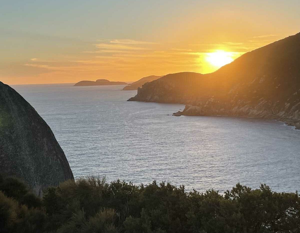
Sunset at South East Cape lighthouse, Wilsons Promontory, Victoria
South East Cape, Wilsons Promontory by Joy O’Neill 

Have you camped at Australia’s extreme north, south, east and west? How far in each direction you can travel in Australia? And have you visited any or all of these must see destinations?

There is 3680 kilometres between north and south, and 4000 km East to West – so a lot to discover in between!

Here’s some more for your bucket list – so many make pilgrimage to visit all of the extreme cardinal points on the Australian mainland in their lifetime.

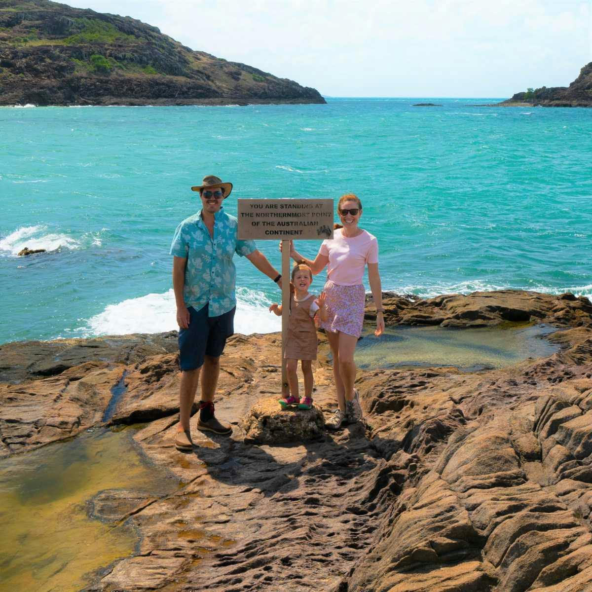
Cape York by Overland Exposure

Most Northerly Point: ‘The Tip’ Cape York, Queensland

The isolated and rugged Cape York, Queensland is a 4WD mecca. Stay at nearby Punsand Bay 5 km west of “The Tip”.

Bounded by Torres Strait to the north, the Coral Sea to the east and the Gulf of Carpentaria to the west, Cape York Peninsula covers about 137 000 square kilometres! Along the way there challenging creek crossings, pristine coastlines, dry savannah woodlands and tropical rainforests.

In August 1770, Lieutenant James Cook named the Peninsula in honour of Prince Edward, Duke of York.

It really is a must do adventure, and one of the most popular extreme points of Australia.

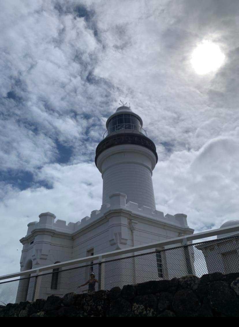
Cape Byron by Jamie Bourk

Most Easterly Point: Cape Byron, Byron Bay, New South Wales

Unlike the other cardinal extremes, you can visit it – and then be sipping chai latte or your avo on toast minutes later in the tourism celebrity, Byron Bay.

Fact: if you want to see sunrise first in Australia – then Wollumbin (Mount Warning) is the spot

You can also sleep over – not in a campground – but in the heritage listed Assistant Lighthouse Keeper’s cottage. Or choose from a huge number of nearby caravan parks.

The Maritime Museum is open 10am to 4pm daily – and do take your binoculars if you want to whale watch in the season. The 22 metre high lighthouse was built in 1901 with one of the most powerful lights in the southern hemisphere.

Cape Byron was also named by Captain James Cook on May 15, 1770 after John Byron, a fellow navigator and the grandfather of the poet, Lord Byron.

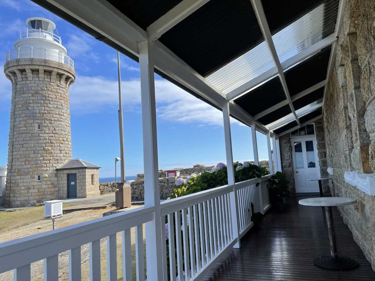
The Lightstation, Wilsons Promontory by Joy O’Neill

Most Southerly Mainland Point: South Point, Wilsons Promontory, Victoria

Known as “The Prom”, the much loved Wilsons Promontory National Park includes 70 km of coastline and 50 000 hectares. The unique peninsula has huge granite headlands, sweeping beaches, spectacular rock formations, fern gullies with open forested areas.

Choose from two National Park campgrounds or other accommodation in Tidal River and there is a 19 km one way trek to the Light Station with cabins and dormitories.

There are other bush walks in the 50 000 hectare national park contains the largest coastal wilderness area in Victoria – popular for diving. You’ll be visiting the largest Marine National Park in Victoria with 70 kilometres of coastline, covering 15,550 hectares!


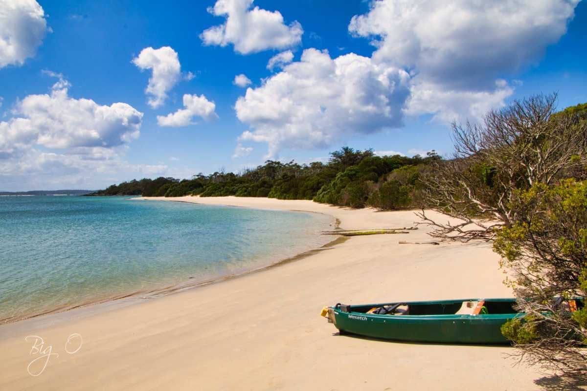
Coastal landscape at Cockle Creek, Tasmania, gateway to Australia's southern tip
Cockle Creek by Ormond Williams

Most Southerly Point of Australia: South East Cape, Tasmania

Travel to Tasmania to reach Australia’s isolated southern-most point, South East Cape. So remote, you have an 18 km return trek to view it. Cockle Creek is as far south as you can drive – fortunately there are two FREE campsites here!

Located in Southwest National Park, the spectacular area is renowned for weather extremes with cold, wet, southerlies. On average, rain falls every second day in summer and more often in other seasons!


Steep Point, Western Australia, the westernmost point of mainland Australia
Steep Point, Western Australia

Most Westerly Point: Steep Point, Western Australia

If you want to see Australia’s most westerly point – then 4WD to Steep Point, between Kalbarri and Carnarvon, WA. Here’s a jaw dropping look at the nearby Steep Point Campsites.

When anchored off the southern tip of Dirk Hartog Island in 1697, the Dutch seafarer Willem de Vlamingh named this point Steyle Hock, translated as Steep Point.

It is located west of Shark Bay, in the proposed Edel Land National Park area.

Download the Camps App for iPhone/iPad or Android

Download on the App Store   Get it on Google Play

Frequently Asked Questions

Can I drive to all of Australia’s extreme cardinal points?

Most are drivable, but you’ll need a 4WD for Cape York (northernmost) and Steep Point (westernmost). Cape Byron (easternmost) has standard vehicle access, while Wilsons Promontory (southernmost mainland) is accessible by regular vehicle. South East Cape in Tasmania requires an 18 km return trek from Cockle Creek.

Which is the most remote extreme point to visit?

South East Cape in Tasmania is the most remote, requiring an 18 km return trek from Cockle Creek (as far south as you can drive). It’s located in Southwest National Park and experiences extreme weather conditions with rain falling every second day in summer.

Where can I camp near Cape York?

Punsand Bay is located 5 km west of ‘The Tip’ at Cape York. Check the Camps App for current details on facilities and bookings.

Is there accommodation at Wilsons Promontory?

Yes, there are two National Park campgrounds and other accommodation options in Tidal River. There’s also a 19 km one way trek to the Light Station which offers cabins and dormitories.

Are there free camping options near any extreme points?

Yes! Cockle Creek in Tasmania, the access point for South East Cape, offers two FREE campsites. This is as far south as you can drive in Australia.

What facilities are available at Cape Byron?

Cape Byron offers heritage accommodation in the Assistant Lighthouse Keeper’s cottage, and numerous nearby caravan parks in Byron Bay. The Maritime Museum is open 10am to 4pm daily. Check the Camps App for current details on camping options.

When is the best time to visit these extreme locations?

Check the Camps App for current details on seasonal access and weather conditions for each location.

What is the distance between Australia’s extreme north and south points?

There is 3680 kilometres between north and south, and 4000 km between east and west across the Australian mainland.

Share

BROWSE ARTICLES BY CATEGORY

Plan the trip of a lifetime with our Travel Guides

Get the App & put all our guides in your pocket!

Stay informed with our free Newsletter

Join our Facebook Community

Share and connect with travellers across Australia

Subscribe to our Email Newsletter

Stay up to date with our free weekly email newsletter and get the latest travel tips, reviews and news straight to your inbox.

Subscribe to our FREE weekly Newsletter and receive

15% Off

your next order in our Online Shop!